Looking at Barnstable and wondering which village fits your Cape Cod life? With seven distinct villages, shoreline and pondfront choices, and a range of home styles, the options can feel exciting and a bit overwhelming. You want the right setting, the right commute, and smart due diligence on flood, schools, and permits. This guide gives you a clear, side‑by‑side view of each village plus practical steps to shop with confidence. Let’s dive in.
Barnstable at a glance
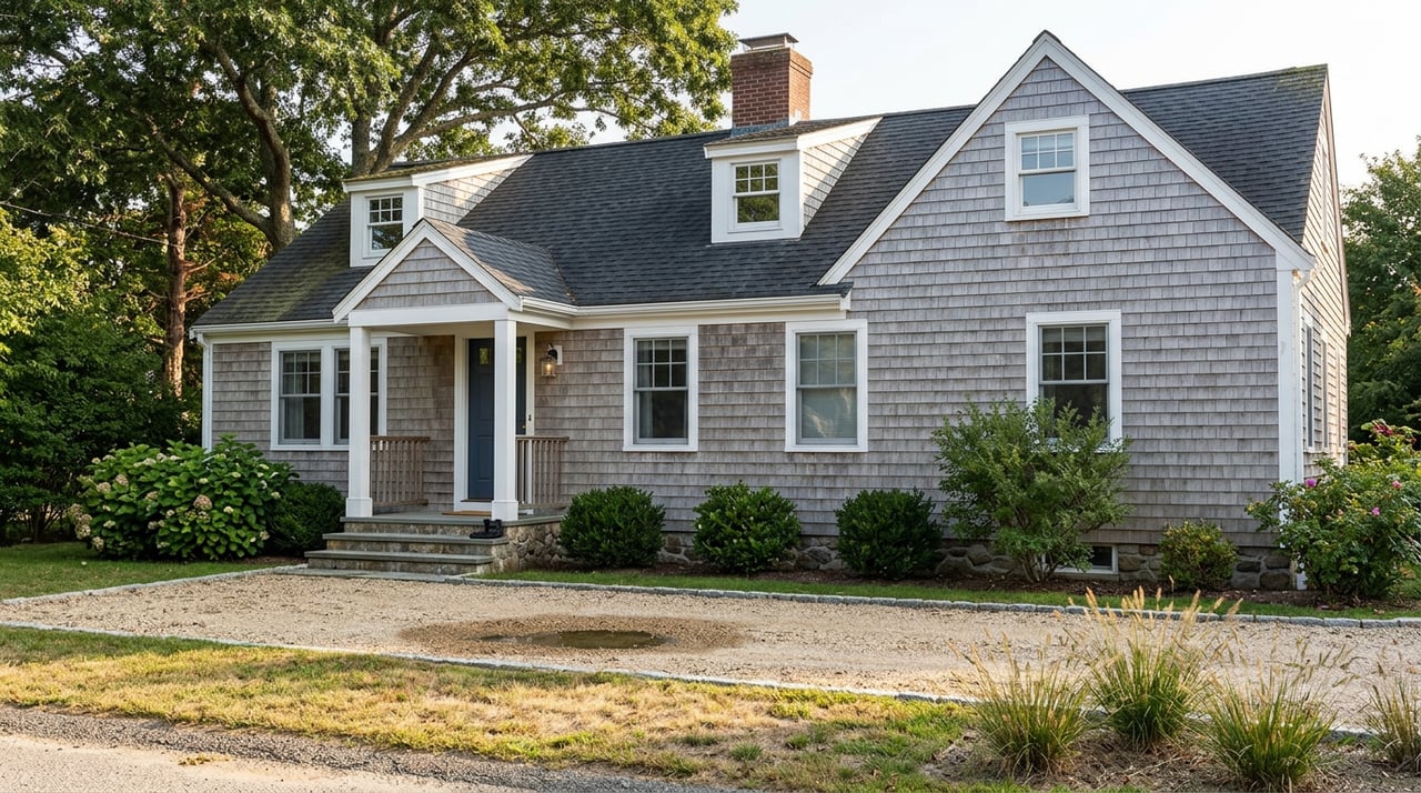
Barnstable is Cape Cod’s largest town, home to about 49,000 residents and a housing market anchored by primarily single-family homes. The town’s owner-occupied median home value is around $602,500, with regional reporting placing the 2023 single-family median near $650,000. These figures frame village-level price tiers. You can explore town housing context in the Cape Cod Commission’s profile and population data in the Census QuickFacts. (Cape Cod Commission housing profile, U.S. Census QuickFacts)
Hyannis is the transportation hub, with ferries to Nantucket and Martha’s Vineyard, regional flights from Cape Cod Gateway Airport (HYA), and the seasonal CapeFLYER weekend train to Boston. Local CCRTA buses connect villages to Hyannis, and many residents drive for daily errands and work. The average commute time is about 25 minutes. (Steamship Authority, FlyHYA, CapeFLYER, CCRTA Riders Guide, U.S. Census QuickFacts)
The seven villages overview
Use this quick-reference to compare setting, housing mix, price tiers, schools, and transport access. Price tiers are relative to the town context above and vary by proximity to water, size, and updates.
| Village | Vibe & setting | Housing snapshot | Relative price tier | Typical elementary campus (verify) | Transport note |
|---|---|---|---|---|---|
| Barnstable Village | Historic 6A main street, working harbor, Sandy Neck nearby | Cottages, single-family, some small multi-family | Mid, with higher premiums for harbor/water | Address-based within Barnstable Public Schools | Quick to Route 6A; short drives to Hyannis services |
| Centerville | South-side beaches and rivers, residential streets | Mostly single-family, post-war to renovated | Mid, with premiums near Craigville/beaches | Centerville Elementary (confirm by address) | Easy to Route 28; seasonal beach traffic |
| Cotuit | Peninsular, boating culture on Cotuit Bay | Classic Capes and cottages, water-oriented | Mid to premium, especially near bayfront | Address-based within district | Quieter village roads; Route 28/6 access |
| Hyannis | Commercial core, harbor, highest service density | Mix of condos, multi-family, single-family | Broad range from entry to premium near harbor | Hyannis West Elementary area (verify) | Ferries, airport, buses, CapeFLYER hub |
| Marstons Mills | Inland, ponds, suburban streets | Primarily single-family on larger lots | Mid | West Villages Elementary (verify) | Route 28 access; lighter summer congestion |
| Osterville | South-side village center, yacht clubs | Estate-scale waterfronts plus inland cottages | Premium, top of town’s range | Address-based within district | Short drive to Hyannis; seasonal harbor activity |
| West Barnstable | Lower density, historic hamlet feel | Historic homes and mid-century stock | Variable; often more affordable than luxury waterfront areas | West Barnstable Elementary (verify) | Rural roads; easy drive to Hyannis |
Sources for village context: Business Barnstable, Barnstable demographics guide, Cape Cod Commission housing profile, Town GIS.
Village snapshots
Barnstable Village
Barnstable Village offers a classic Route 6A main street, a working harbor, and quick access to Sandy Neck. Housing spans historic cottages to renovated single-family homes, with waterfront commanding clear premiums. You can expect a compact village feel and short drives to larger services in Hyannis. If you are exploring harbor-facing parcels, review flood zones and coastal permitting early. (Business Barnstable, Town GIS flood maps)
Centerville
Centerville sits on the south side with river access and popular public beaches near Craigville. Most homes are single-family, from post-war ranches to updated properties, with price lifts closer to the water. Routes 28 and 6 make regional travel straightforward, though beach-season traffic can be busy. Verify school assignments by address with the district. (Barnstable demographics guide, Barnstable Public Schools)
Cotuit
Cotuit’s village center and Cotuit Bay setting create a strong boating and shellfishing culture. Housing is a mix of classic Capes and water-oriented cottages, with bayfront and harbor-proximate parcels typically at a premium. Roads are quieter and narrower, and summer seasonality can shape daily patterns. Always check shellfish, dock, and shoreline rules before planning waterfront improvements. (Barnstable demographics guide, Town GIS)
Hyannis
Hyannis is the town’s commercial and transit core, with a broad housing mix that includes condos, multi-family, and single-family homes. Proximity to Hyannis Harbor can raise values, while condos and smaller properties provide entry points. The ferry terminals, airport, CCRTA buses, and the seasonal CapeFLYER make this the best village for multi-modal travel. Expect lively summer activity near Main Street and the harbor. (Business Barnstable, Steamship Authority, CapeFLYER)
Marstons Mills
Known for freshwater ponds like Mystic Lake and Mill Pond, Marstons Mills offers an inland alternative with a suburban neighborhood pattern. Single-family homes on modest to larger lots are common, and the area experiences less tourist traffic than the coast. Route 28 provides straightforward regional access. Consider pondfront rules, septic siting, and water-quality protections when evaluating waterfront-on-pond properties. (Cape Cod Commission housing profile, Town GIS)
Osterville
Osterville is recognized for estate-scale homes, yacht clubs, and a refined village center on the south side. Waterfront and near-water parcels often sit at the top of Barnstable’s price spectrum, with inland cottages and renovated homes creating a wide internal range. Owners should factor shoreline regulations, flood insurance, and potential seawall or revetment needs into budgets. Regional planners are active on long-term coastal resilience in these areas. (Business Barnstable, Cape Cod Commission coastal resources)
West Barnstable
West Barnstable preserves a historic hamlet feel with lower density and notable heritage districts. Housing includes historic and mid-century homes, with pricing that can be more attainable than luxury shoreline markets. You will rely on short drives for services and shopping, and many properties offer more space. Check parcel-level details for any shore access and confirm school assignments by address. (Cape Cod Commission housing profile, Town GIS, Barnstable Public Schools)
Waterfront vs inland: key trade-offs
Waterfront across Barnstable includes ocean, bay, river, and pond settings, each with distinct rules and costs. Prices typically reflect exposure, view, and dock or mooring rights. Inland options often deliver more space and easier maintenance at lower premiums. Balance your wish list against long-term resilience and permitting realities.
- Flood exposure and insurance. Use FEMA’s Flood Map Service Center and the Town’s interactive flood layers to evaluate parcel-level zones. Lenders often require flood insurance in designated special flood hazard areas. (FEMA Map Service Center, Town GIS flood maps)
- Shoreline permitting. In Massachusetts, docks, seawalls, and coastal work are regulated by state and local authorities. Build time and cost for permitting into your plan. (Cape Cod Commission coastal resources)
- Infrastructure and wastewater. Water districts and sewer availability vary by village. Confirm water and septic details early, especially for renovations or additions. (Barnstable Water Resources FAQs)
- Long-term resilience. Coastal planners map sea-level rise and low-lying roads across the Cape. Consider both near-term flood risk and long-range adaptation in your target area. (Cape Cod Commission coastal resources)
Waterfront buyer checklist
- Run a FEMA and Town GIS flood check for each address.
- Confirm shoreline jurisdiction and permits for any dock, wall, or beach work.
- Ask about moorings, shellfish rules, and harbor association covenants.
- Verify water/sewer or septic specifics and any upgrade requirements.
- Obtain multiple insurance quotes, including flood, before final negotiations.
Schools and enrollment basics
Barnstable Public Schools operates multiple K–3 elementary campuses, a 4–5 intermediate campus, and centralized secondary schools. Enrollment and campus assignments depend on your property address. Sturgis Charter Public School in Hyannis is a regional public charter high school option. Always confirm current grade spans and assignments with the district before you decide. (Barnstable Public Schools, Sturgis Charter Public School)
School boundary next steps
- Use the district’s school pages to confirm your address assignment and grade spans.
- If timing a move, ask the district about enrollment windows and required documents.
- For private or charter options, check application timelines and capacity.
Commute and transportation
Most Barnstable residents report an average commute of about 25 minutes. For regional connections, Hyannis concentrates ferries to both islands, regional flights from HYA, buses at the Hyannis Transportation Center, and the seasonal CapeFLYER weekend train to Boston. Local errands are car-centric, and summer traffic on Route 6 and near beaches can be heavy, especially on weekends. Plan travel windows around seasonal patterns. (U.S. Census QuickFacts, Steamship Authority, FlyHYA, CapeFLYER, CCRTA Riders Guide)
How we help you buy in Barnstable
Choosing between seven villages, shoreline types, and infrastructure differences is easier with a local, detail-driven plan. With hospitality-rooted service and Compass tools, our team pairs neighborhood insight with concierge-level coordination so you can shop confidently and move smoothly.
- Bespoke search and previews across all seven villages, including lifestyle, commute, and waterfront considerations.
- Vendor coordination for inspections, septic and well checks, and insurance quotes so you can compare options with clarity.
- Access to Compass programs that can simplify your move, including Concierge for listing prep if you are selling to buy, Private Exclusives for off-market opportunities, and Bridge Loans for timing flexibility.
- Clear, address-level due diligence around school assignment, flood zones, shoreline rules, and water/sewer service.
Ready to find your place in Barnstable? Connect with Diana Lucivero to schedule a private Cape Cod consultation.
FAQs
What is Barnstable’s housing overview for buyers?
- Barnstable is primarily single-family housing, with condos and multi-family concentrated in denser areas like Hyannis; the owner-occupied median value is around $602,500 and 2023 single-family medians were reported near $650,000, providing townwide context for village tiers. (Cape Cod Commission housing profile, U.S. Census QuickFacts)
How do I check if a Barnstable property needs flood insurance?
- Look up the parcel in FEMA’s Flood Map Service Center, then confirm with your lender and insurance providers; also review the Town’s interactive flood layers for local context. (FEMA Map Service Center, Town GIS)
Which villages offer the easiest access to ferries and flights?
- Hyannis concentrates regional travel: ferries to both islands, Cape Cod Gateway Airport, the Hyannis Transportation Center for buses, and the seasonal CapeFLYER weekend train to Boston. (Steamship Authority, FlyHYA, CapeFLYER)
How are Barnstable Public Schools organized?
- The district runs multiple K–3 elementary campuses, a 4–5 intermediate campus, and centralized middle and high schools; assignment is address-specific, and Sturgis Charter Public School in Hyannis is a regional charter option. (Barnstable Public Schools, Sturgis Charter Public School)
What should I know about waterfront permitting in Barnstable?
- Docks, seawalls, and other shoreline work are regulated by state and local authorities; plan for permitting timelines and costs, and consult Town Conservation and state guidance before improvements. (Cape Cod Commission coastal resources)
Is daily rail commuting to Boston available from Barnstable?
- The CapeFLYER is a seasonal weekend service to Hyannis rather than a daily commuter rail; most year-round commutes are by car or bus, with average travel times around 25 minutes locally. (CapeFLYER, U.S. Census QuickFacts)
How do I confirm water and sewer for a specific property?
- Check the Town’s water and wastewater FAQs and verify service or septic details at the parcel level before planning renovations or additions. (Barnstable Water Resources FAQs)
